What Makes a Walkable Hudson Valley Town? Scores, Blocks & Daily Life
True walkability is when your daily life fits inside a 10–15 minute loop from your front door—coffee, groceries, school, parks, and the train—without feeling like you’re taking your life in your hands crossing a road.
⸻
The Big Misunderstanding About “Walkable”
Walkability isn’t a vibe. It’s a system.
A town can have a charming Main Street and still fail the real test if:
• the grocery run requires a car,
• the train is technically nearby but not practical, or
• the roads feel hostile once you leave the postcard blocks.
In the Hudson Valley especially, “walkable” often means two different things:
1. Weekend-walkable (stroll to brunch, antique shops, farmers market)
2. Daily-walkable (errands + school + train + park… repeatedly, year-round)
You’re buying for #2. Even if you love #1.
⸻
My Hudson Valley Walkability Score (0–100)
If you want this to be useful, you need a repeatable score. Here’s the one I use in showings.
1) The Errand Loop (0–30)
Can you realistically walk to:
• groceries
• pharmacy
• coffee
• a couple services (dry cleaner, hardware, bank, etc.)
Bonus points if you can do it without crossing a “fast road.”
2) The Safety + Comfort Layer (0–25)
This is the “would you actually do it?” test:
• continuous sidewalks (or safe shoulders)
• crossings that feel protected
• lighting
• traffic speed/visibility
• stroller / dog / kid friendliness
3) Transit Reality (0–25)
Not “is there a station,” but:
• is it inside the loop, or a hike?
• is it safe at night?
• do you have parking as backup?
• does the walk feel calm or chaotic?
4) Daily Life Anchors (0–20)
These make walkability stick:
• parks/playgrounds
• schools
• library
• community spots you’ll use weekly
The more your life “plugs in,” the more you’ll actually walk.
Quick read:
• 80–100: true daily-walkable
• 60–79: walkable with a couple compromises
• 40–59: “cute” but you’ll drive more than you think
• <40: mostly car-dependent (even if the town looks charming online)
⸻
The Criteria (Simple Checklist)
Use this in the field.
• Block pattern: connected streets, few dead ends, easy crossings
• Errand loop: groceries + pharmacy + coffee + services
• Transit: station/bus that’s actually practical for your routine
• Parks & play: green space within the loop
• Night test: would you walk after 7pm, alone, in winter?
⸻
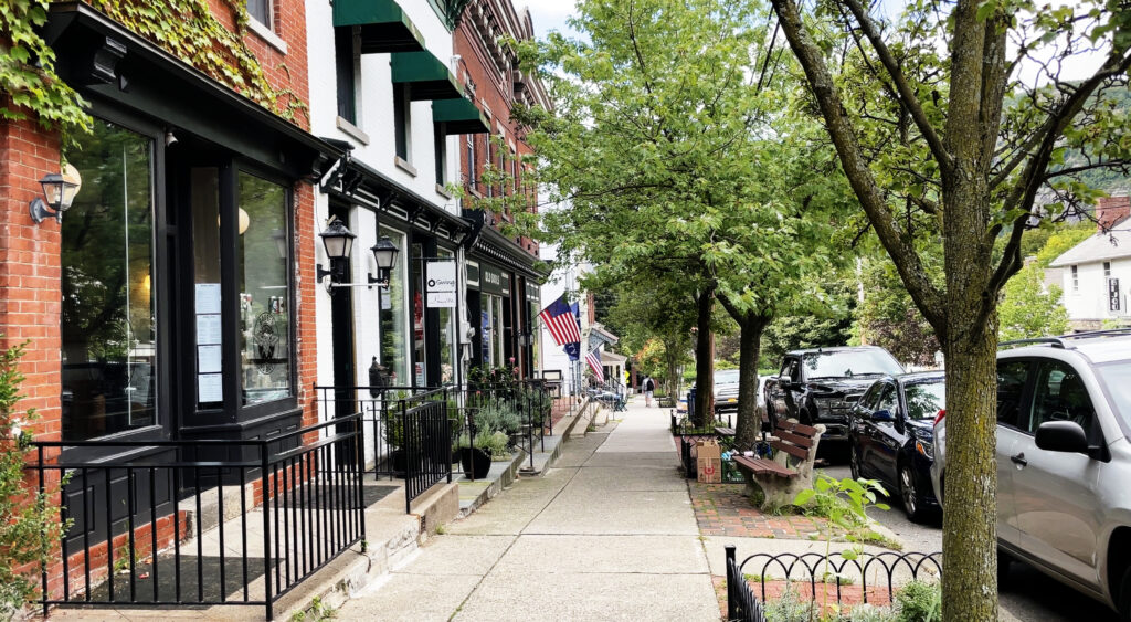
How to Evaluate a Block Like a Local
This is where buyers win.
1) Walk it three times (yes, really):
• morning rush
• mid-day quiet
• after dark
2) Time the loop, don’t “guess” it.
Map your real routine:
house → coffee → school → train → groceries → home
If one link breaks, the loop breaks.
3) Listen for the deal-breakers.
• train horn rhythms
• road roar
• delivery routes
Noise isn’t “bad,” but it becomes your soundtrack.
4) Winter truth test.
A block can be “walkable” in May and miserable in January. Check:
• hill grade
• shaded ice zones
• snow clearing patterns
• where meltwater refreezes
⸻
FAQs
Is a long Main Street good or bad?
Great for variety. But the real question is: where is your daily anchor?
If the station or grocery is a mile away, you’ll end up doing the “drive for one thing” habit.
Can hills kill walkability?
They don’t kill it — they define it.
If the hill sits between you and the train/groceries, it changes your behavior fast (especially in winter).
Do I still need parking if the town is walkable?
Usually yes. Hudson Valley walkability is often hybrid: you walk daily, but you still drive for big shops, weekend hikes, and winter convenience.
⸻
Want me to run this properly?
Ask for my Walkability Scorecard and I’ll send:
• a shortlist of candidate blocks by town (based on your routine)
• a 0–100 score for each block
• and the “compromise notes” so you know what you’re trading for charm